People were streaming along the sidewalks and biking down the street – parents with children, couples, retirees, and the full ethnic diversity of our region. Where were they all going? We were leading one of our tours of walkable urban places and were amazed. Our group had just reached Park Avenue after having come up from the East Falls Church Metro. It felt like market day, and in fact it was – with the weekly Farmers Market, the Taste of Falls Church and the Fall Festival all taking place last Saturday.
Mayor Tarter, Vice Mayor Connelly, and Councilmember Hardi were there to meet us and tell us about the Little City. The Mayor talked about the community’s efforts to become an even better place for walking and bicycling, including adding Capital Bikeshare. We learned about the effort to bring new amenities like the Harris Teeter, and investment that will diversify the tax base to reduce pressure on residential property taxes. We learned about the city’s commitment to environmental sustainability and quality of life.
With the help of Falls Church’s planning department, our guides for the morning, we looked at old and new development along Washington and Broad Streets, talking about urban design, sidewalk widths, best designs for ground-floor retail and more. It was easy to feel the difference between walking along a narrow sidewalk next to high-speed traffic and the new wider sidewalks with street trees.
At the Northgate development, we talked about the benefits of redevelopment for dealing with long-standing stormwater problems. Old parking lots fuel torrents of floodwater into creeks like Four Mile Run. New development must meet current stormwater control standards and significantly reduce runoff. The sidewalk retention basins are one tool, although the big clunky ones at Northgate will have to be chalked up as a learning experience!
The Harris Teeter is the big new addition and lies within reach of most city residents, generating a significant number of walking trips to the store. Later, we learned from developer Bob Young about the sustainability features of his Flower Building and the affordable apartments for teachers in the Read Building. Parking needs are being reduced through shared parking at the Hilton Garden Inn. So many people arrive by shuttle from Metro, that they don’t need as much parking as they have.
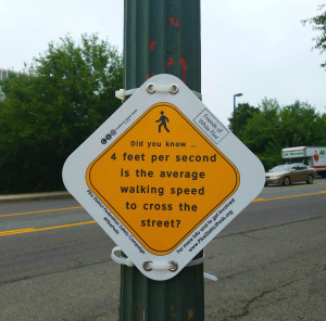
The two Metro stations that bear the Falls Church name became a big topic of conversation, particularly because neither is as accessible as it could be. The long walk from East Falls Church Metro demonstrated, without a doubt, the need for a western entrance to the Metro at Washington Street. The western entrance would place the Metro much closer to many Falls Church and Arlington residents.
Metro studies show that attracting more riders who walk and bike to the stations is far more cost-effective than building very expensive parking structures. Almost all of Falls Church lies within one mile of one of the two Metro stations. So it’s easy to see why good sidewalks, bike lanes and bikeshare are great ways to connect the community to the two Metro stations.
East Falls Church Metro is already a champion in attracting bike commuters, but the demand is such that a bike station is in progress, designed by the same folks who created that amazing glass bike station at Union Station in DC. Bikeshare will add a whole new level of convenience for the commute to Metro, because you’ll be able to ditch the heavy bike lock. But the city almost didn’t win the funding in the face of opposition from outer suburban legislators and highway lobbyists. So we jumped into the fray, sending an alert to our Falls Church members, who responded in record numbers to send letters of support that helped to win the funding.
We didn’t have time to go to Tinner Hill or the West Falls Church Metro, but we learned about both and plan to come back. West Falls Church Metro is a disjointed place today and many talk about how the big parking lots feel unsafe at night. So it would be a real win to create a walkable urban place, with a new high school, mixed-use development, and a more vibrant Virginia Tech campus.
We wrapped up our tour in the pocket park at the Spectrum development, but people wanted to keep talking, so we adjourned for a great lunch at the Mad Fox.
Falls Church is a wonderful place, and in demand because of its walkability, convenient access to jobs and services, and nearby Metro stations. Carefully planned development in the commercial corridors will provide needed housing, convenient new services, help the tax base, and contribute to a walking and biking friendly community. We look forward to returning to see the next stages in the evolution of the Little City.”