Category: Resources

Is Washington D.C. a Walkable and Bikeable City? These People Say It Is

Ginnie from the Walkable Living Stories campaign.

What a way to kick off summer, with the Coalition for Smarter Growth launch today of Walkable Living Stories.

The campaign shares the stories of dozens of Washington D.C. residents who have chosen a walkable lifestyle. When you get to the site, you find yourself clicking on the interactive map to see where the 38 percent of the car-free or car-lite district households reside and how they do it.

You can click on your community, an individual storyteller, or a neighborhood that interests you. You may even click on someone you know (Editor: Such as Dan Malouff from Dupont Circle, who works with us at Arlington County Commuter Services and is a blogger for Greater Greater Washington). You will, at the least, find that the people are easily recognizable and relatable. They may be your co-worker, friend, neighbor, fellow cyclist, walker, or someone you see daily on the metro on your way to yoga.

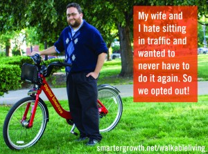
I clicked on Ginnie, head librarian at D.C. Public Libraries. She says that Capital Bikeshare has changed her life and uses it to get to work, even on rainy days. Ginny has made sharing (checking out books from the library) part of her work life, so it made perfect sense for her to extend the sharing lifestyle (bikesharing) to her personal life?

And, don’t we already live in a shareable world? Sharing has definitely made my life easier, more fun, healthier, and more affordable. We can already appreciate the benefits of sharing with free wi-fi hot spots, potlucks, clothing swaps, gamification, Facebook, Twitter, Wikipedia …

It’s human nature to share, and how great it is for the Coalition for Smarter Growth to expose us all to the ways that D.C. residents creatively and enthusiastically pursue this lifestyle.

Let’s hope this campaign makes the District (and the region) more walkable.

Submit your own story here.

Click here to read the original story>>

STATEMENT: Virginia Commonwealth Transportation Board Approval of $17.6 Billion Six-Year Capital Spending Program: A Road to Ruin?

Statement on Virginia Commonwealth Transportation Board Approval of $17.6 Billion Six-Year Capital Spending Program

A Road to Ruin?

Today with no debate, the appointed Commonwealth Transportation Board approved the largest transportation spending program in Virginia history, $17.6 billion in capital spending.

“We are shocked by the lack of discussion of the spending priorities in the Six-Year Plan, by the failure to tie the program to specific policy goals, and the assumption that simply adding road capacity will solve our transportation problems.  The plan includes a number of wasteful mega-projects that have been strongly criticized as unnecessary including Route 460 ($1.4 billion), the Coalfields Expressway ($2.8 billion), Charlottesville Bypass ($244 million), N-S Corridor ($1 billion plus), and a long range $11.4 billion plan for I-81.

The CTB doesn’t understand the benefits of more efficient land use – of cities, towns, and compact transit-oriented development —  along with transportation demand management programs (carpooling, telecommuting, etc.) that reduce driving demand.  They don’t understand changing demographics and market demand that have led to big declines in vehicle miles traveled.  The plan includes just 9% of the total for transit even though 69% of the state population lives in the Urban Crescent.

In short, we believe this program will be remembered for squandering billions of tax dollars while making Virginia’s patterns of development less efficient, more oil dependent, and less competitive.”

Stewart Schwartz, Executive Director


About the Coalition for Smarter Growth

The Coalition for Smarter Growth is the leading organization in the Washington D.C. region dedicated to making the case for smart growth. Our mission is to promote walkable, inclusive, and transit-oriented communities, and the land use and transportation policies needed to make those communities flourish. To learn more, visit the Coalition’s website at www.smartergrowth.net.


###

Walking tour explores Fort Totten’s present and future

Development at Fort Totten has been slow despite access to 3 Metro lines, its close proximity to both downtown DC and Silver Spring, its access to the Metropolitan Branch Trail, its green space and its affordability. But as demand increases for housing in the District, this previously-overlooked neighborhood could become a hot spot.


Photo by tracktwentynine on Flickr.Last Saturday, the Coalition for Smarter Growth concluded their spring walking tour series with “Fort Totten: More than a Transfer Point,” a look at future residential, retail and commercial development near the Fort Totten Metro station. Residents and visitors joined representatives from WMATA, DDOT and the Office of Planning on a tour of the area bounded by South Dakota Avenue, Riggs Road, and First Place NE.

Today, vacant properties and industrial sites surround the station and form a barrier between it and the surrounding area. Redeveloping them could improve connections to the Metro and make Fort Totten a more vibrant community.

There is a significant amount of new residential, retail and commercial development planned within walking distance of the Metro station. But Saturday’s tour began with the only completed project, The Aventine at Fort Totten. Built by Clark Realty Group in 2007, the 3-building, garden-style apartment complex consists of over 300 rental units as well as ground-floor retail space.


The Aventine at Fort Totten, the newest apartment complex in Fort Totten. All photos by the author unless otherwise noted.Visitors were ambivalent about the success of the Aventine due to its small amount of retail space and lack of connectivity to surrounding neighborhoods. While residents noted that it created more options to live close to Metro, representatives of the Lamond Riggs and North Michigan Park civic associations agreed the development differed from the original vision for the project.

They called it an example of the need to continually engage real estate developers and local government agencies to ensure that new development is of a high quality and responsive to the local context. Throughout the tour, residents said that future development proposals should adhere to DC’s urban design guidelines, improve pedestrian access and have a plan to mitigate parking concerns.

Between South Dakota Avenue and the Metro station, the Cafritz Foundation will redevelop the old Riggs Plaza apartments to build ArtPlace at Fort Totten. When finished, the 16-acre project will contain 305,000 square feet of retail, 929 apartments, and 217,000 square feet of cultural and art spaces, including a children’s museum. Deborah Crain, neighborhood planning coordinator for Ward 5, noted that ArtPlace will include rental units set aside for seniors and displaced Riggs Plaza residents.


An ad for ArtPlace at Fort Totten at its future home.As one of the largest landowners near the Fort Totten Station, WMATA has a huge stake in future development around the station. They own approximately 3 acres of land immediately west of the station along First Place NE that is currently used as surface parking lot for commuters. Stan Wall, Director of Real Estate at WMATA, discussed the great potential for development on the current parking lot mentioned that the agency will solicit proposals for development of the area in the near future.


Parking lot at Fort Totten station.Anna Chamberlain, a DDOT transportation planner, talked about how streetscape improvements could calm traffic, making streets around the Metro station more pedestrian- and bike-friendly. DDOT is also working to improve connections to the Metro, as some areas lack clearly defined walking paths. The agency will begin designing a path connecting the Metro to the Metropolitan Branch Trail within the next few months.


New sidewalks and street trees on Riggs Road.The final stop on the tour was Fort Totten Square, a joint effort by the JBG Companies and Lowe Enterprises to build 350 apartments above a Walmart and structured parking at South Dakota Avenue and Riggs Road. DDOT has completely rebuilt the adjacent intersection to make it safer for pedestrians and more suitable for an urban environment, replacing freeway-style ramps with sidewalks, benches, crosswalks and improved lighting.

Jaimie Weinbaum, development manager at JBG, says they’re committed to working with the city and residents to make Fort Totten Square an asset to the community. They’ve promised to place Capital Bikeshare stations there and would like to have dedicated space for Car2go as well.

With help from the private sector and public agencies like DDOT and WMATA, Fort Totten could become a model for transit-oriented development, but much of the new construction won’t happen for a long time. Until then, residents eagerly await the changes and continue to work with other stakeholders toward creating a vision that will benefit everyone.

Photos courtesy of Greater Greater Washington

Click here to read the original article >>

Testimony before the WMATA 2025 Special Committee in Support of the WMATA Momentum Plan

The Coalition for Smarter Growth is the leading organization in the Washington D.C. region dedicated to making the case for smart growth. Our mission is to promote walkable, inclusive, and transit-oriented communities, and the land use and transportation policies and investments needed to make those communities flourish.

Having helped win remarkably strong regional consensus for transit-oriented development as the framework for regional growth — reflected in the Region Forward and Economy Forward vision plans of the Council of Governments, and in the priorities of local leaders — the Coalition for Smarter Growth views investment in the Next Generation of Transit as a top priority and essential for supporting this regional vision.

We view the Momentum plan as the vision and framework for setting regional transit investment priorities and for working with all of our jurisdictions to create an expanded, well-maintained, and seamlessly integrated transit system our region needs to remain healthy, prosperous, efficient and competitive.

The Coalition for Smarter Growth is fully committed to achieving the Next Generation of Transit, as reflected in our report earlier this year. Key components include:

  • Rehabilitating and improving our Metrorail system as the region’s top priority investment;
  • Ensuring high-capacity public transportation networks to support a sustainable region of livable, walkable centers, and neighborhoods;
  • Expanding and improving the bus system by adding more service and providing bus priority on roadways is critical to meeting growing ridership demand and using our roads more efficiently;
  • Seamlessly integrating, physically and operationally, Metrorail, new priority corridor networks, bus rapid transit, light rail, streetcars, commuter rail and our bicycle/pedestrian infrastructure.

The Momentum Strategic Plan effectively makes the case for the value of the Metro system to our region and of reinvesting and strategically expanding the system. We believe that WMATA, through an extensive consultation process with COG and the jurisdictions, is the best entity for leading the strategic planning for our region’s Next Generation of Transit.

Perhaps no statistic stands out in the Momentum plan more than the value of investing in 8-car trains, which provide 35% more capacity-equal to 35,000 more passengers per hour to jobs downtown. To achieve this with roads, we would need 16-18 new lanes of highways. For comparison, widening just 2.5 miles of I-95 recently cost state and federal taxpayers $261 million or $52 million per lane mile.

Other statistics that we find compelling are that:

  • Regional riders will save an additional $100 million per year by purchasing less fuel and other out-of-pocket travel costs.
  • The region will avoid building 30,000 new parking spaces, saving $675 million.

Investing in Metro is the most critical step in supporting compact, efficient transit-oriented development, lowering per capita infrastructure costs and saving land.

If we are to continue our regional success and grow without reaching total traffic gridlock, we must rehabilitate Metro, maximize the capacity of the existing system and strategically expand Metro and connecting transit services. This must be our top priority.

Thank you.

Stewart Schwartz
Executive Director

Prince George’s tries to make TOD easier

Prince George’s County wants to encourage growth in the right places by speeding up the approval process for transit-oriented development. The county council unanimously passed a bill last week that just might do it.

061313 pgtod

Developers have often said they don’t want to do business in Prince George’s because of its lengthy and unpredictable development review process. Bill CB 20 creates a fast-track development review process for projects within ½ mile of the county’s 15 Metro stations and the Bowie MARC station.

Projects are eligible for the speedier process if the Planning Board finds they meet best practices for urban design, like mixing housing with retail and making engaging streetscapes.

The bill aims to increase transit ridership, reduce auto dependency, and encourage walking for more trips. It’s one of several recommendations county planners say could draw more investment to the county’s Metro station areas.

Concerned about attracting unwanted commercial uses, the bill contains a long list of uses that are not eligible for the expedited review, including adult entertainment, liquor stores, pawn shops, strip malls, and drive-throughs.

An earlier version of the bill would have eliminated most requirements for public meetings or site plan review. This could have potentially rushed low-quality projects to approval without giving the Planning Board and the public enough time to review proposed projects.

Not surprisingly, many people opposed it, and the County Council tabled the bill last year before putting together a roundtable to discuss ways to improve incentives for transit-oriented development. The current bill combines 2 overlapping versions councilmembers Eric Olson and Mel Franklin submitted earlier this year.

The bill’s most important feature is streamlining the review process. It prevents the County Council from arbitrarily dragging out the process, a power they’ve abused in the past that creates uncertainty and discourages developers from working in the county. Developers say that the unpredictability of approvals in Prince George’s County often makes it not worth the time and money spent there.

While the current bill shortens the review process, it still gives the Planning Board and members of the public enough time to offer feedback. If the Planning Board approves a proposal, the County Council has a few days to decide whether or not to review it as well. Project applicants or residents can also use this time to appeal the board’s decision.

Bill CB 20 is just one of many actions Prince George’s County has taken to encourage investment at Metro stations. Recently, county officials have also reduced the impact fees developers pay to support schools and public safety. Economic analysts say excessive fees discourage investment altogether, meaning the county won’t even receive the fees it seeks to collect.

Another element of ensuring development goes at Prince George’s Metro stations is having a good countywide plan. There is a town meeting this Saturday, 10 am-1 pm at the University of Maryland, to work on a plan for the county’s growth over the next 20+ years. You can help push for a plan that works in concert with this legislation to encourage TOD at Metro station sites.

Photo Courtesy of Elvert Barnes on flickr.

Click here to read the original story>>
Capital Bikeshare becoming an economic development tool

Capital Bikeshare is doing more than moving people around on red bikes. It’s also helping sell houses and apartments and draw people to businesses.

The bike-sharing system, which has more than 175 docking stations across the District, Arlington and Alexandria, has become the latest tool to spur development and attract young people. Soon it will be coming to Montgomery County, and other communities are trying to bring it to their neighborhoods.

Craigslist showed 72 active housing listings touting proximity to bikeshare on Friday. It is featured on Airbnb as a perk for visiting tourists seeking to rent out locals’ homes. Wal-Mart is planning to add the docking stations to its stores coming to the District, according to bikeshare officials.

About eight in 10 bikeshare members who responded to an annual survey said they are more likely to patronize a business if it is accessible by bikeshare. Those riders are a coveted demographic. They tend to be higher educated, wealthier and younger — plus more likely to be male and white — than the general population. Stewart Schwartz, who runs the Coalition for Smarter Growth, noted the service attracts new and young residents who are looking for walkable places to live and work. They are likely to be innovators who will help spur the economy, he said.

Arlington County has viewed bikeshare as a economic development tool from the start, according to Chris Hamilton, who runs Arlington County commuter services. He said retailers, restaurants and shop owners want to be near the docking stations. “I think it’s helping our local economy,” he said.

The bikeshare stations were not always so coveted, though. A few years ago, neighbors near Lincoln Park in Capitol Hill fought against a docking station near them. But now, officials said, some developers are seeking them out.

Christopher Leinberger, a George Washington University professor and Brookings Institution fellow, said that Capital Bikeshare could become akin to cars and Metro in changing the dynamics of development around the region. Leinberger has studied the economic impact of Metrorail, which has spurred billions of dollars of development around the region in the past 37 years. “It could be that significant and yet it’s really cheap,” he said.

But bikeshare does not have the stability of Metro stations, noted Matt Klein, president of D.C. developer Akridge. Bikeshare docks are solar-powered, which has made them easy to install without needing to wire into the power grid. But that same ease of installation makes them easy to take away. By contrast, fixed rail Metro stations provide a predictable and unmovable piece of transportation infrastructure that can transport far more people than a 40-bike docking station, he said. Developers can build around a Metro station confident it will likely attract a permanent and steady flow of people.

Still, Klein said bikeshare is nice to have near Akridge projects. “It would fall more into an amenity category than important transportation infrastructure,” he said. “It may evolve into something more.”

Photo Courtesy of The Examiner

Click here to read the original story>>

Testimony before The Hon. Andrea Harrison, Chair, Prince George’s County Council Re: Support for CB-20-2013: Expedited Transit-Oriented Development

Please accept these comments on behalf of the Coalition for Smarter Growth. Our organization works to
ensure that transportation and development decisions in the Washington, D.C. region, including the
Maryland suburbs, accommodate growth while revitalizing communities, providing more housing and travel
choices, and conserving our natural and historic areas.

We wish to express our support for CB-20-2013, which is an important step to reducing an institutional
barrier to attracting new investment at Metro stations. CB 20 offers a public process that gives greater
predictably to the review of development applications while also preserving essential public accountability.

We ask the Council also consider creating an evaluation mechanism in the bill so that its performance can be
regularly assessed and reported out to the Council, Planning Board and public. This bill’s expedited
development review process, along with other incentives for TOD, should be regularly assessed so that the
County can fine tune incentives and procedures that are most effective at achieving the goal of quality
transit-oriented development.

While we believe CB 20 will be helpful in encouraging more quality transit-oriented development
applications, we suggest that this does not substitute for rationalizing and reducing the complexity of the
zoning ordinance. We urge the Council to pursue the longer-term and systematic recommendations of the
2009 report: Prince George’s County Zoning Ordinance and Subdivision Regulations Streamlining the
Development Review Process.

Thank you for your consideration.

Sincerely,

Cheryl Cort
Policy Director

Transit Initiatives Boosted by Employers

It’s been clear for several years that more people than ever support public transit. In vote after vote, people consistently say yes to taxes for transit creation.

In 2012, 79 percent of transit ballot initiatives were approved. That’s good news for everyone. For every $1 billion investment in transit, 60,000 jobs are created, making transit one of the best job generators in our economy.

A recent study by Good Jobs First, covered this week in Politico, showed that key support for transit is coming from employers in metro areas. Called “Bosses for Buses,” the study says that support from the heads of universities and hospitals explains why state and local ballot initiatives for transit consistently win.

“The remarkable local support for transit demonstrated by so many employers is truly heartening,” Greg LeRoy, executive director of Good Jobs First and lead author of the study, told Politico. “But the lack of a unified corporate voice on federal transit issues is equally disheartening.”

The study profiles outstanding networks and companies that have supported ballot initiatives, like Washington University in St. Louis, Mo. Cleveland’s two largest employers, The Cleveland Clinic and University Hospitals of Cleveland, were involved in a campaign for the HealthLine, one of the nation’s most successful Bus Rapid Transit lines. In Phoenix, a spinoff of the Greater Phoenix Chamber of Commerce developed a “Transit Means Business” campaign. And in the D.C. area, a coalition named “Purple Line Now!” is working with community groups like the Coalition for Smarter Growth and PRISCM to gain a sorely needed arc-shaped light rail line that would connect inner-ring suburbs and four subway “spokes” in the Maryland counties that straddle D.C.

The whole country is standing up for transit. What’s up with Congress? Hopefully, the newly organized bi-partisan Public Transit Caucus that Rep. Daniel Lipinski (D-Ill.) and Rep. Michael Grimm (R-N.Y.) have created will make a difference with their fellow legislators.

For those folks who are walking home tonight from their food service jobs because there is no bus after midnight, here’s hoping the 1 percent in Congress step up for transit.

Click here to read the original story>>

Montgomery parking requirements looser, but not enough

Montgomery County’s new zoning code will allow less parking in new developments in order to use land more efficiently and encourage alternatives to driving. However, the regulations still require parking in ways that will hinder the walkable urban places the county wants to build.


Space for people, or space for cars? All photos by the author.For four years, the Planning Department has been revising its complicated, unwieldy zoning code. First written in 1928, the code hasn’t been updated since 1977, when the county was still mostly suburban. The new code will go before the County Council in a public hearing June 11.

Under the current code, buildings must have lots of parking, even near transit or in areas where most people don’t drive. The new parking regulations are simpler and allow developers to build fewer parking spaces, though they do require other amenities, like bike racks, changing facilities and spaces for car sharing or carpools.

New rules require less parking, more amenities

The new code reduces parking requirements throughout the county, especially in its parking benefit districts where public parking is available, like Silver Spring, Bethesda, Wheaton, Montgomery Hills and eventually White Flint.

Restaurants currently must have 25 parking spaces per 1000 square feet, a little smaller than a Chipotle. Under the new rules, a restaurant would only need between 4 and 10 spaces, depending on whether it was in a parking district. Meanwhile, office buildings outside a parking district will only need 2.25 spaces per 1000 square feet, compared to 3 today.

Some rules have been simplified. The current law requires different amounts of parking for different kinds of stores; for instance, a “country market” must provide 5 parking spaces for each 1000 square feet, while a furniture store needs only 2. Under the new code, all stores would be required to have 3.5 spaces per 1000 square feet in parking districts, and 5 spaces elsewhere.

New buildings would also have to accommodate alternate modes of transportation by providing bike parking. Larger buildings will have to include space for car sharing, while developers would be able to swap out car parking spaces for carpool spaces, bikeshare stations or changing facilities.

However, the parking requirements for housing won’t change much. Single-family homes and townhomes would still need 2 off-street parking spaces or 1 if they’re in a parking district, same as before, while new apartments would need at least 1 parking space, regardless of where they are. However, apartment developers could build less parking if they “unbundle” them, meaning that residents could buy or rent a space separately from their unit.

Do we still need parking requirements?

While the new requirements are an improvement, some local groups argue that there shouldn’t be parking requirements at all. The Coalition for Smarter Growth, the Montgomery County Sierra Club, and the Action Committee for Transit, where I sit on the board, have all come out against parking minimums.


Parking requirements don’t always make great places.Why? For starters, parking is expensive to build and rarely pays for itself. Construction costs for a space in a parking lot are about $3,500, compared to $30,000 for one in a garage and $100,000 for one underground, not counting the cost of land. Parking fees rarely cover these expenses alone, so the costs get passed on to the public in other ways, like higher prices at a restaurant that’s charged higher rents by its landlord.

Meanwhile, our communities pay for a glut of parking. Surface parking lots that are only full on Black Friday take up valuable space that could be used for buildings or parks instead. And even attractively designed parking garages like this one in Rockville still create a dead space, hurting street life. On top of that, parking lots produce a lot of stormwater runoff, polluting waterways.

This isn’t to say that we shouldn’t have any parking, but the costs of excess parking outweigh the benefits. As Matt Yglesias writes in Slate, people will continue to want parking, and any developer who wants to stay in business will satisfy them without being told to:

Almost 100 percent of Washington-area residents like to sleep on a soft comforable surface at night. But there’s no regulatory requirement that residential buildings contain mattresses. The lack of mattress mandates doesn’t mean people are forced to sleep on the floor. It means that if people want to sleep on a mattressand they generally dothey need to go buy one.

Once you take away the Agricultural Reserve, residential neighborhoods, and other uses, you’re left with about 4% of Montgomery County that’s available for development. That land is valuable, and we need to use it well. Covering it with big parking lots isn’t the right solution, but that’s what our current zoning code requires. While the new law’s a step in the right direction, it may not go far enough to create the kind of places we want.

The County Council will hold a public hearing on the Zoning Rewrite on Tuesday, June 11 at 7:30pm. To sign up to testify or submit written comments, visit their website.

Photos courtesy of thecourtyard on Flickr.

Read the original article here>>

Preservation Virginia lists land slotted for Tri-County Parkway as ‘endangered’

Historic Civil War parkland slotted for a controversial new parkway that would connect the counties of Prince William and Loudoun has made the “endangered” list of one of the oldest non-profit preservation organizations in the country.

Preservation Virginia, founded in 1889, focuses on the preservation of historic sites around the state, including Jamestown and the Cape Henry Lighthouse in Virginia Beach. For the first time, the group included land slated for the proposed Tri-County Parkway, a 10-mile, four-lane thoroughfare that would connect I-66 in Prince William with Route 50 in Loudoun, on its list of “most endangered” sites for 2013.

Part of the parkway, which has drawn increased scrutiny in recent weeks, would run through historic Manassas Battlefield land and rural Prince William.

“The Tri-County Parkway would run directly past the August 28, 1862 position of the right flank of Confederate troops led by Stonewall Jackson and the left flank of the Union General Pope’s troops, taking up to 20-35 acres of land from the national park and historic district,” the group said on its Web site.

“Opponents of the highway…believe that it would negatively impact the national park and historic district and predict that the parkway and connecting roads will open up rural land in Prince William … and Loudoun County.”

The group joins a chorus of preservation advocacy groups raising concerns about the project, including the National Trust for Historic Preservation, National Parks Conservation Association, Piedmont Environmental Council, Coalition for Smarter Growth, and Southern Environmental Law Center.

The administration of Gov. Robert F. McDonnell (R) and the business community in Prince William and Loudoun believe the road is vital to the success of the fast-growing region. Supporters say the parkway — which could eventually connect farther east to Interstate 95 — would create jobs and drive economic development in the area, ease congestion and provide a key connection to Dulles International Airport and between two rapidly growing counties.

Elizabeth Kostelny, the executive director of Preservation Virginia, said that the organization is interested in the project in part because the National Park Service has pushed for assurance that if the parkway is built, Route 29 through the battlefield would be closed at Route 234 and a bypass around the park would be built.

“We’re not opposing it outright,” Kostelny said of the Tri-County Parkway. “We remain concerned about the traffic through the Manassas battlefield [and] having assurances those roads will be closed to commuter traffic.”

The Prince William Board of County Supervisors recently delayed a vote on Prince William’s state transportation priorities due to an outcry about the road. The parkway proposal has long had the support of both Prince William and Loudoun supervisors.

Prince William Board Chairman Corey A. Stewart (R-At Large) said in an interview that the board’s delay does not mean that supervisors plan to pull their support. He also said that despite setback and opposition, he believes the proposed parkway will move forward.

“I think they will be successful,” he said of the state’s plans for the road. “The reason is this … we have two of the fastest growing counties in the United States that do not have adequate connections to each other.”

Despite opposition in recent weeks — including from six state area Republican legislators and U.S. Rep. Frank R. Wolf (R-Va.) — state officials say they plan to press forward and hope to explain their plans for the parkway more clearly and how it would benefit residents.

Click here to read the original story>>