Prince George’s County and regional smart growth advocates sent a letter today to Prince George’s County Executive Rushern Baker urging him to rethink transportation priorities to fulfill the County’s efforts to foster transit-oriented economic development.
Category: Transit-Oriented Development

Testimony Re: Southern Green Line Station Area Sector Plan and Endorsed Sectional Map Amendment
Regrettably, the Coalition for Smarter Growth expresses its opposition to the proposed amendments to the Adopted Southern Green Line Station Area Sector Plan and Endorsed Sectional Map Amendment. While we have testified in support of many helpful bills and resolutions that advance the County’s efforts to attract high quality investments around its Metro stations, we regret that this proposed overlay, while well-intentioned, is likely to do more harm than good …
Letter to Montgomery County Planning Board Re: State Transportation Funding Priorities
Dear Planning Board: Thank you for this opportunity to comment on the county’s Transportation Priority Letter. My name is Cheryl Cort and I am speaking on behalf of the Coalition for Smarter Growth, the leading non-profit group advocating for transit and walkable communities in the DC region, which counts thousands of supporters in Montgomery County. We’d like to remind the Board that state law governing the priority letter process “requires MDOT and the local jurisdictions seeking project fundi…
How to testify in support of the DC Zoning Update at the Zoning Commission
How to testify in support a progressive update to the DC zoning code before the DC Zoning Commission
Sign up to testify in advance 1. In person: call to get on the list –DC Zoning Commission at: 202-727-
6311. You can also sign up to testify by arriving by 6:00 pm at the Zoning Commission hearing
room on the hearing date. Hearings will start at 6pm and continue until everyone has testified or
11:30 pm.
Full schedule of November 2013 hearings on the D.C. Zoning Update
DC Zoning Update Hearings Monday, November 4 – Subtitles A, W, X, Y, and Z
o Topic – Authority, practice, and procedure of government bodies that work
with zoning Tuesday, November 5 – Subtitle B o Topic – Definitions and terminology used in zoning code Wednesday, November 6 – Subtitle D
o Topic – Accessory apartments in low-density residential areas and
corner stores Thursday, November 7 – Subtitles E and F
o Topic – Corner stores
Accessory Apartments & Corner Stores: What you should know about the DC Zoning Proposals
ACCESSORY APARTMENTS: Issue heard on Nov. 6, regarding Subtitle D: Residential House (R) Zones: Allow one accessory unit in single family residential zones; Allow accessory apartment in owner-occupied home or existing accessory building (e.g. carriage house or garage) with access through alley or side yard, special exception for any construction or additoin
Zoning Over Pizza
If you’ve signed up to speak in front of the Zoning Commission at the public hearings on the zoning update this November (we need more supporters to sign up!), this workshop is for you! Over snacks, we talked about what the Zoning Commissioners will be looking for when you speak, and what you can say to best show your support for the zoning update. We’ll break into small groups and brainstorm what we can say.
Largo site is front-runner for new hospital in Prince George’s
Prince George’s County Executive Rushern L. Baker III (D) is backing a selection committee’s recommendation that a Largo site be chosen for a new, $654 million state-of-the-art regional hospital.
The board of directors for Dimensions Healthcare System, the nonprofit organization operating four hospitals in Prince George’s County, will discuss the recommendation during its meeting today.
“The selection committee will recommend the Largo site officially at the Dimensions board meeting,” Baker spokesman Scott Peterson said Wednesday. “This is the selection committee recommendation, not the county executive’s. Mr. Baker concurs with this recommendation.”
The proposed 280-bed hospital would replace the aging Prince George’s Hospital Center in Cheverly.
Dimensions Healthcare also operates Laurel Regional Hospital, the Bowie Health Campus and Glenridge Medical Center in Lanham.
On Tuesday, a selection committee comprised of members from county government, Dimensions Healthcare, the University of Maryland Medical System and the Maryland Department of Health and Human Hygiene recommended the Largo site, located next to the Largo Metro station. The other contender for the hospital was the site of the former Landover Mall.
The Coalition for Smarter Growth, a Washington, D.C.-based organization promoting walkable, transit-oriented community development in the Metropolitan area, issued a statement Wednesday morning applauding the recommendation.
“Prince George’s County took a big step forward toward a more sustainable economic and environmental future with the decision to place the new regional medical center at the Largo Town Center Metro station,” Cheryl Cort, Coalition for Smarter Growth policy director, said in the statement.
The Largo site is comprised of 70 acres of land owned by Oak Brook, Ill.-based Retail Properties of America, and several adjoining properties under private ownership. It is adjacent to the Boulevard at Capital Centre shopping center and the Largo Metro station.
The site is within close access to Interstate 495.
“A Metro-accessible regional medical center helps Prince George’s catalyze transit-oriented economic development and capture a larger share of the region’s growth,” Cort said in the statement. “Locating this major new medical facility at a Metro station brings both healthcare and thousands of jobs to a significantly more accessible location for county residents.”
Dimensions Healthcare announced in July that the search for the new hospital had been narrowed to two sites, the Largo site and the site of the old Landover Mall, which was demolished in 2007.
The Landover site provides bus service to the New Carrollton Metro, nearly three miles away. The Largo Metro station is somewhat closer to the Landover site, at 2.5 miles walking distance, but not directly accessible by bus.
The hospital construction is being funded through state and county government, as well as Dimensions and the University of Maryland Medical System.
Advocates urge Gov. O’Malley to target funds to transportation projects supporting smart growth; Gov. O’Malley to announce transportation spending on Monday in Bethesda
FOR IMMEDIATE RELEASE
Friday, August 2, 2013
Contact:
Kelly Blynn, Coalition for Smarter Growth, 202-675-0016 x 127
Ben Ross, Action Committee for Transit, 301-706-6826
Advocates urge Gov. O’Malley to target funds to transportation projects supporting smart growth
Gov. O’Malley to announce transportation spending on Monday in Bethesda
In advance of Governor O’Malley’s visit to Bethesda on Monday, several advocacy groups working in Prince George’s and Montgomery Counties released a letter Friday applauding funding pledged so far for transit, bicycling, and pedestrian infrastructure, while expressing concern over costly new highway capacity projects.
“All of our groups worked hard to build grassroots support for the transportation funding bill so we could have the ability to help realize Maryland’s smart growth and climate protection goals,” said Cheryl Cort, Policy Director at Coalition for Smarter Growth. “Now we’re concerned about how much of the money will go to projects that undermine those efforts.”
The concerns stem from the long list of costly highway capacity projects identified by each County as high priorities, and a state selection process that is done behind closed doors. A few weeks ago, those fears were confirmed when O’Malley announced his list of projects for Prince George’s that included two major new road capacity projects for $250 million
“$150 million for an interchange at MD 4 and the Suitland Parkway is a massive public investment to support sprawling development,” said Karren Pope-Onwukwe, co-chair of Prince George’s Advocates for Community-based Transit. “This new interchange project will draw activity away from Metro stations and inside the Beltway communities, where we should be focusing development.”
In Montgomery, concerns center around four new road widening and interchange projects within the Route 28/198 corridor. These would cost half a billion dollars to duplicate the ICC, drawing away commuters and toll revenue.
“We have already wasted more than $2 billion on the ICC, which continues to be underutilized,” said Ethan Goffman of the Montgomery County Sierra Club. “Our investments should be in reducing carbon emissions and sprawl, not simply adding more and more capacity for cars.”
In addition, previous announcements indicate that Maryland may use a public-private partnership, effectively borrowing against future revenues, to help pay for Montgomery and Prince George’s top priority transportation project, the Purple Line.
“While we’re thrilled with the Purple Line’s continued progress, we’re concerned about the state’s desire to provide the local share of construction funding via a public-private partnership,” said Ben Ross, vice president of the Action Committee for Transit which has worked for the Purple Line for more than 25 years. “We need the full $1.1 billion to open the line by 2020. State funds that may be needed for that purpose should not be committed to lower-priority projects until we are certain that alternative financing is a good deal for taxpayers and riders.”
Advocates listed their top priorities for the suburban Washington region as building the Purple Line, funding the MARC Growth and Investment Plan, and funding Maryland’s share for WMATA’s reinvestment plan, Momentum. They also urged the state to expand investment in local road improvements to create new options for drivers, bicyclists, and pedestrians, such as a multimodal redesign of MD 355 (Rockville Pike) in the White Flint area.
Following on the heels of O’Malley’s announcement of his ambitious goals for addressing climate change last week, including doubling transit ridership, advocates hope his transportation announcements will remain consistent. “We want to see the Governor ensure that all transportation projects funded by the state support the excellent smart growth and climate goals his administration has set,” said Kelly Blynn, Coalition for Smarter Growth.
The transportation advocates’ letter can be found here and is signed by the Action Committee for Transit, Bike Maryland, Clean Water Action, Coalition for Smarter Growth, Prince George’s Advocates for Community-based Transit, Montgomery County Sierra Club, Montgomery County Young Democrats, Montgomery Countryside Alliance, Prince George’s County Young Democrats, and the Washington Area Bicyclists Association (WABA).
About the Coalition for Smarter Growth
The Coalition for Smarter Growth is the leading organization in the Washington D.C. region dedicated to making the case for smart growth. Our mission is to promote walkable, inclusive, and transit-oriented communities, and the land use and transportation policies needed to make those communities flourish. To learn more, visit the Coalition’s website at www.smartergrowth.net.
###
Proposed D.C. Zoning Code Re-Write Sparks Debate
 The first major re-write of Washington’s zoning code since it was established in 1958 is expected to be submitted by the Office of Planning today, ending six years of work and triggering another lengthy public process before the District’s Zoning Commission, which will have the final say on new zoning policies.
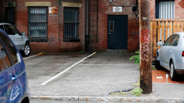
Among the most controversial proposals is the effort to make D.C. less car-dependent by eliminating mandatory off-street parking space minimums in new development in downtown D.C. Planning Director Harriet Tregoning had also proposed to eliminate parking minimums in transit corridors, but recently changed her position to only reduce those minimums.
Tregoning’s change has left advocates on both sides of the debate unhappy.
“We’re encouraged that there’s not going to be an absolute rule that there will be no parking minimums. We think that’s a step in the right direction, but we are still very concerned because the planning director of the District of Columbia has shown her hand. She, for whatever reason, does not believe there is a parking issue throughout much of the District,” said AAA MidAtlantic spokesman Lon Anderson.
“We are disappointed the city has listened to the opposition to progressive reforms and is backing down on the important reform of removing parking minimums in areas that are well served by transit. The proposal would address a number of the biggest problems with parking minimums but we still maintain that parking minimums are not the right approach to building a more affordable, sustainable city,” said Cheryl Cort, the policy director for the Coalition for Smarter Growth.
At the heart of the controversy lies the question: how much parking does a growing, thriving city need as developers continue to erect new housing, office and retail space near Metro stations, in bus corridors, and downtown D.C. The alleged scarcity of parking spaces today is a common complaint of motorists, but those who favor dumping the parking minimums say residents and visitors will have adequate alternatives to automobile ownership, like car-sharing services, Metro rail and bus, and Capital Bikeshare. Smart growth advocates also point out developers will still be able to build parking if the market demands it, but the decision will be left to them, not decided by a mandate.
“We’re building a lot of parking that generates a lot of traffic, undermining the best use of our transit system,” Cort said.
“We spent the last 100 years building our society to be automobile dependent and then to try to change that in a very short period of time is really imposing an awful lot in a region that is still very, very dependent on the automobile,” counters Anderson.
About 38 percent of all D.C. households are car-free, according to U.S. Census data.
Photo courtesy of AP Photo/Michael Dwyer. Copyright 2013 by WMAL.com. All rights reserved.