Author: Ayesha Amsa

Comments in Support of West Falls Church Plan Amendment 2018-II-1M

Chairman McKay and Members of the Board,

Please accept the attached joint comments on the West Falls Church Comprehensive Plan Amendment (CPA) 2018-II-1M before you tomorrow. We write to express our support for the redevelopment of the West Falls Church Transit Station Area and urge you to consider our recommendations below and vote in favor of the CPA.

These comments are being submitted jointly on behalf of the Coalition for Smarter Growth, the Audubon Naturalist Society, the Northern Virginia Affordable Housing Alliance, the Sierra Club Great Falls Group, Friends of Holmes Run, Faith Alliance for Climate Solutions, and the Fairfax Alliance for Better Bicycling.

Thank you,
Sonya Breehey

CSG Comments on the Route 1 Multimodal Study

Dear Mr. Reinhard and team, 

The Coalition for Smarter Growth supports the Virginia Department of Transportation’s (VDOT’s) preferred alternative to convert Route 1 through National Landing from an elevated highway to a slower, safer, and vibrant urban boulevard. This is a forward-thinking proposal that will eliminate the current barrier that the elevated Route 1 presents and provide greater cohesion between Pentagon City and Crystal City. 

It is essential that this new urban boulevard be designed in a way that truly prioritizes the needs of people walking, biking, and using transit. We recognize there are concerns regarding the safety of people without grade separation. However, we believe with the right design and safety measures, this new boulevard can be safe, accessible and provide a more connected community overall. 

Physically designing the roadway for slower speeds by narrowing travel lanes and reducing corner radii, providing physically protected intersections and bike lanes, and allowing off-peak on-street parking are proven designs that make streets safer. Added safety measures should also include utilizing pedestrian lead intervals at signals and automated speed enforcement.  

Conversion to a boulevard presumes we do everything we can to promote non-automobile access to National Landing, Reagan National Airport, and other commuting destinations. This includes expanding employee transit benefits, utilizing parking pricing, and providing more frequent and reliable transit services. Providing attractive transit options will help intercept commuters from Prince George’s, Fairfax County, and other points south traveling to jobs in Arlington and the District.

We urge VDOT and Arlington County to reimagine Route 1 with an at-grade design that emphasizes safety and accessibility for all road users and provides a vibrant urban boulevard through the heart of National Landing. 

Thank you for your time and consideration of our comments.  

Sonya Breehey
Northern Virginia Advocacy Manager

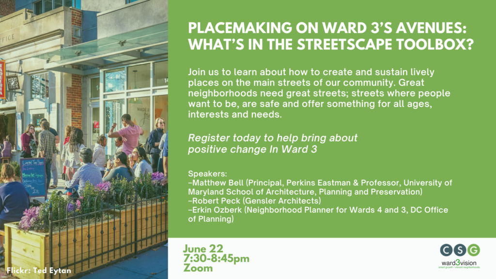
Event: Placemaking on Ward 3’s Avenues – What’s in the Streetscape Toolbox?

Event: Placemaking on Ward 3’s Avenues – What’s in the Streetscape Toolbox?

June 22, 2021 – CSG and Ward3Vision hosted an event to learn about the many tools we have to create and sustain lively places on the main streets of our community.  We discussed why streets are important, what makes them comfortable, interesting, useful and inviting, and what models we might learn from. The event also helped the audience understand how affordable housing actually gets financed. The event also helped the audience understand the ‘software’ that helps make it all work.

Featured speakers:

  • Matthew Bell FAIA (Principal, Perkins Eastman & Professor, University of Maryland School of Architecture, Planning and Preservation)
  • Robert Peck (Gensler Architects)
  • Erkin Ozberk (Neighborhood Planner for Wards 3 and 4, DC Office of Planning)
  • Leigh Catherine Miles (Executive Director, Tenleytown Main Street)

Event materials

  • View the event recording on youtube.
  • Presentation slides:
CSG Testimony: Attainable Housing Strategies

CSG Testimony: Attainable Housing Strategies

We strongly support the direction of the Planning Department’s recommendations for more diverse housing typologies in Montgomery County, especially in places near transit, amenities, and jobs. Inequitable, unsustainable land use patterns are a systemic problem at the root of some of our most difficult social issues. Montgomery County should not be a place where your zip code can predict your future income, health, or other life outcomes.

Middle housing zoning reform will not change neighborhoods overnight or solve all our housing challenges. Rather, smart land use decisions will lay the foundation for a better, more just society where people can find a place to live that fits their needs, their income, and provides access to opportunities. It will help Montgomery County become a place where more people can choose to live car-lite or car-free and drive less; a place where more people can start a family or age-in-place.

CSG Comments: Draft Vision Zero 2030 Plan

CSG Comments: Draft Vision Zero 2030 Plan

We commend Montgomery County for its commitment to ending all traffic fatalities and serious injuries. Vision Zero is important for many reasons, chief among them to make our transportation system one where all users can safely move. We cannot create great places for people to live, work, and play in Montgomery County if people do not feel safe getting there. The county also faces other challenges, such as the county’s rapidly aging population who would like to age-in-place and combating climate change, of which Vision Zero is a critical component of the solution.  

RELEASE: New Analysis Measures Racial and Economic Disparities in Transit Access Across National Capital Region

For Immediate Release 
June 17, 2021 

Contact 
Ben Fried, TransitCenter, 347-675-5592
Stewart Schwartz, Coalition for Smarter Growth, 703-599-6437
Ron Thompson, DC Transportation Equity Network, 202-780-7940

New Analysis Measures Racial and Economic Disparities in Transit Access Across National Capital Region

The Transit Equity Dashboard illustrates inequities in access to jobs, health care, and other services for Black and brown residents.

An analysis released today measures racial and economic inequities embedded in the National Capital Region’s transportation network. The Transit Equity Dashboard, produced and launched today by the national foundation TransitCenter, maps and quantifies the disparities in transit access caused by segregation and discrimination in land use and transportation policy. TransitCenter is releasing findings for an initial six U.S. metropolitan regions over the coming week.

The COVID crisis made racial inequities in public health and economic status very plain, and demonstrated just how critical transit is for our essential workers. “As recovery from the pandemic accelerates in greater DC, our organizations call on political leaders to prioritize public investments that will shrink gaps in transit access and address other inequities as a result, putting the region on the path to a just recovery,” said Ron Thompson of the DC Transportation Equity Network.

People of color are more likely to rely on transit in the Capital region — in 2019, 18% of Black residents took transit to work, compared to 12% of white residents. But disparities in transit access linked to race and economic status are undermining transit’s capacity to function as a “ladder of opportunity” connecting people to jobs, education, medical care, and other necessities. Using data from transit agencies and the U.S. Census, the dashboard reveals these disparities.

In addition to job access, the dashboard measures transit access to grocery stores, hospitals, parks, and colleges, reflecting the fact that most trips are not commute trips, and that equitable transit enables people to access more than the workplace. Key findings include:

  • The average Latinx resident can access 157,040 potential jobs in 45 minutes using transit, the average Black resident can access 160,893 jobs, and the average Asian resident 184,018 jobs — compared to 256,140 for the average white resident.
  • On a weekday evening, it takes 40 minutes for the average resident of the Washington D.C. region to take transit to the nearest hospital, and even longer for the average Asian or Latinx resident. Poor access to healthcare is associated with worse health outcomes; it also means long transit commutes for essential healthcare workers working second- and third-shift roles. 
  • On a weekend morning, it takes more than three times longer to reach the closest hospital using transit than using a car, and nearly three times longer to reach the third-nearest grocery store. The dashboard measures time to the third-closest grocery store to show how effectively transit connects people to a variety of options.

Achieving more equitable transit in greater DC will require changes to both the broad sweep of transportation and land use and the specifics of transit operations and fare policy. Advocates have proposed reforms to remediate the racial and economic divides in the region’s transit access, including:

  • Redesigning bus networks in DC, Northern Virginia, and Maryland to expand access to jobs.
  • Operating transit more frequently throughout the day and week, in order to better meet the needs of essential workers.
  • Dedicated transitways to make bus and streetcar service faster and more reliable, both within DC and throughout the region.
  • Addressing the east-west economic and racial divide that cuts across the region as well as the racial and economic residential segregation apparent within each jurisdiction.

Transit agencies and local governments in the Capital region should also adopt new performance targets that measure inequities like those identified by this dashboard, and assess progress toward equitable transit access.

“TransitCenter’s maps highlight once again the need to address the region’s east-west racial and economic divide, as well as the need to prioritize dedicated bus lanes, more affordable fares, and networks redesigned for more frequent service and improved access to jobs,” said Stewart Schwartz, Executive Director of the Coalition for Smarter Growth.

While noting the recent actions by the WMATA board on service changes and fare affordability, the Alexandria DASH bus network redesign, and planning for regional network redesigns, the groups collectively urged much more rapid progress.

###

RELEASE CORRECTED: Removal of 495/270 Toll Lanes from Regional Plan

RELEASE CORRECTED: Removal of 495/270 Toll Lanes from Regional Plan

PRESS RELEASE – CORRECTED (to identify the correct motion maker)

For Immediate Release
June 16, 2021

Contact:
Stewart Schwartz, Executive Director, 703-599-6437

Concern about Climate Change Leads to Historic Vote at the Region’s Transportation Planning Board

Vote removes 495/270 toll lanes from the long-range plan, requires next plan to meet climate goals

Today, in the latest of several significant debates at the Transportation Planning Board, the regional body of local and state officials charged with creating a regional long-range transportation plan Visualize 2045, the body voted to remove the I-495/I-270 toll lanes from the draft plan and to require the development of a climate-friendly plan by 2024.

Gary Ehrenrich, representing Montgomery County Executive Marc Elrich made the motion to remove the I-495/I-270 toll lane project from the plan and it passed 16 to 12 with 6 abstentions. Mayor Bridget Newton of Rockville and other Maryland leaders spoke firmly about the reasons for removing the project, with the vote attracting near universal support from local Maryland jurisdictions as well as support from DC and some Virginia jurisdictions. This was followed by a vote on the draft 2022 long-range transportation plan – now minus the toll lane project, and with provisions advanced by Montgomery County Councilmember Evan Glass to commit the TPB to create a new plan by 2024 that significantly reduces greenhouse gas emissions. The TPB voted 26 to 4 with 4 abstentions on the measure.

“The unifying theme in today’s vote was the overwhelming concern of elected officials about climate change. It motivated the vote to remove the toll lane project and to do more to reduce greenhouse gas emissions from our region’s transportation sector,” said Stewart Schwartz, Executive Director of the Coalition for Smarter Growth.

A number of outer Virginia jurisdictions thought it was too late to change the current draft plan which will move forward into air quality modeling and adoption in the spring of 2022, but they ultimately also joined Maryland and DC in voting to begin work to adopt another more climate-friendly plan by 2024. “We wish the TPB would have acted this cycle to fundamentally reform the current plan because we have no time to waste,” said Schwartz. “Nevertheless, they made an important commitment today to adopt a more climate-friendly plan by 2024.”

  • The scientific consensus is that we must slash our emissions by 2030. The Biden Administration and our regional Council of Governments have each set a goal of cutting CO2 emissions 50% below 2005 levels by 2030.
  • Transportation is this region’s and the nation’s largest source of CO2 emissions.
  • Recent studies show that electric vehicles will not be enough, therefore the region will need to use transit-oriented development, transit, and demand reduction solutions to reduce vehicle miles traveled and associated emissions.
  • The Council of Governments’ recent Voices of the Region Survey found that 84% of the region’s residents want elected officials to prioritize climate change in transportation plans.
  • Public comment on Visualize 2045 has overwhelmingly supported a plan that addresses climate change.

“Removal of the I-495/I270 project from the draft plan means it will not be included in the federally mandated air quality conformity modeling, a huge roadblock for the controversial project,” said Schwartz. “I believe the many flaws in the Hogan Administration’s approach to the project including failure to analyze more sustainable and less destructive alternatives, failure to hear the public outcry or account for the strong opposition of nearly every local jurisdiction, and rush to commit the state to a long-term contract before finishing all of the environmental impact studies, contributed to the resounding rejection of the project today at the TPB.”

“There may also be implications for Virginia’s 495Next HOT lane extension contract with Transurban but that would have to be confirmed with VDOT,” said Schwartz. “Many of us had urged Virginia not to rush into that deal because of the controversy in Maryland and the similar failure in Virginia to consider alternative approaches. We want to see solutions for the American Legion Bridge and 495, and the best solutions lie in addressing the east-west jobs/housing imbalance, focusing jobs and housing near transit, and in the growth in telecommuting.”

###

CSG Testimony: Comments in Support of West Falls Church Redevelopment Plan

CSG Testimony: Comments in Support of West Falls Church Redevelopment Plan

For nearly 25 years since our founding by the region’s leading conservation groups, we have helped the region work toward a vision for a network of transit-oriented communities, a vision committed to by Fairfax County and endorsed by all 23 jurisdictions in the Council of Governments’ Region Forward plan and supporting plans. It is a vision shared by the conservation community, affordable housing, bike/ped and transit advocates, and much of the business community.

We support the West Falls Church TSA – with recommendations: 1) swift action to make the streets that surround the Metro station site safer for local residents, bicyclists, pedestrians, and transit-
users and 2) addressing climate change by slashing our emissions from transportation. L

We are signatories to the joint supportive comments submitted by leading conservation and housing groups in the Fairfax Healthy Communities Network – which you have in your packet. In addition to CSG, the signatories are Audubon Naturalist Society, Northern VA Affordable Housing Alliance, Sierra Club – Great Falls Group, Friends of Holmes Run, and Faith Alliance for Climate Solutions.

Testimony: TPB Draft CLRP and Resolution by TPB Board Member Evan Glass

Testimony: TPB Draft CLRP and Resolution by TPB Board Member Evan Glass

June 15, 2021 

Hon. Charles Allen 
Chair, National Capital Region Transportation Planning Board 

Re: TPB Draft CLRP and Resolution by TPB Board Member Evan Glass 

Chair Allen and members of the TPB: 

We hope you all agree that climate change is an existential threat. You also know that transportation is our number one source of emissions and that electrical vehicles will not be enough to get us to the COG and national goals of a 50% reduction in CO2 emissions by 2030. The last CLRP (2018) is only estimated to reduce CO2 by 23%  by 2045, 

In the COG scientific and statistically significant Voices of the Region Survey, 84% of the region’s residents  indicated they want elected officials to prioritize climate change in transportation plans. Public comment on  Visualize 2045 has overwhelmingly supported a plan that addresses climate change. 

Therefore, we urge you to address the issues raised in Councilmember Glass’ resolution and by many other  members of the TPB seeking a CLRP that more effectively addresses climate change. At a minimum, we urge you in  adopting the draft CLRP for air conformity modeling, to concurrently commit to the TPB to adopting a new CLRP by  2024 that meets COG’s climate goals. This includes conducting a rigorous initial climate strategy analysis this year  (not just an academic exercise) and beginning immediately in 2022, developing the next CLRP by 2024. 

We are running out of time. We need your leadership. 

Thank you. 

Stewart Schwartz
Executive Director

Bill Pugh 
Senior Policy Fellow